
Before you build the scaffold, see what is actually wrong.
High-resolution drone imagery of roofs, chimneys, gables and high stonework — interpreted by specialists in stone, lime and moisture, before you commit to exploratory access costs.
Based in Kerry · All 32 counties · Subject to weather, airspace and site conditions.
Could a drone survey help me?
Before you pay to reach the problem, show us what you can see from the ground.
Answer a few questions, upload photos and mark the area you're worried about. Phoenix Stone will review it and confirm whether aerial inspection makes sense. It takes about 2 to 4 minutes.
This tool doesn't diagnose building defects. It helps us understand your concern.
A better first look at difficult buildings.
Inspect areas that are difficult or costly to see properly from ground level.
Understand visible condition before deciding what access or repair is actually justified.
Imagery reviewed in the context of lime, stone, moisture and traditional construction.
A clear photographic record to support repair planning, quotations and future comparison.
This is the view you'd otherwise pay a scaffold to reach.
Captured on a live job. In minutes, the drone reaches ridges, chimney crowns and wall heads that would normally need access equipment just to look at — so the money goes on the repair, not on finding it.
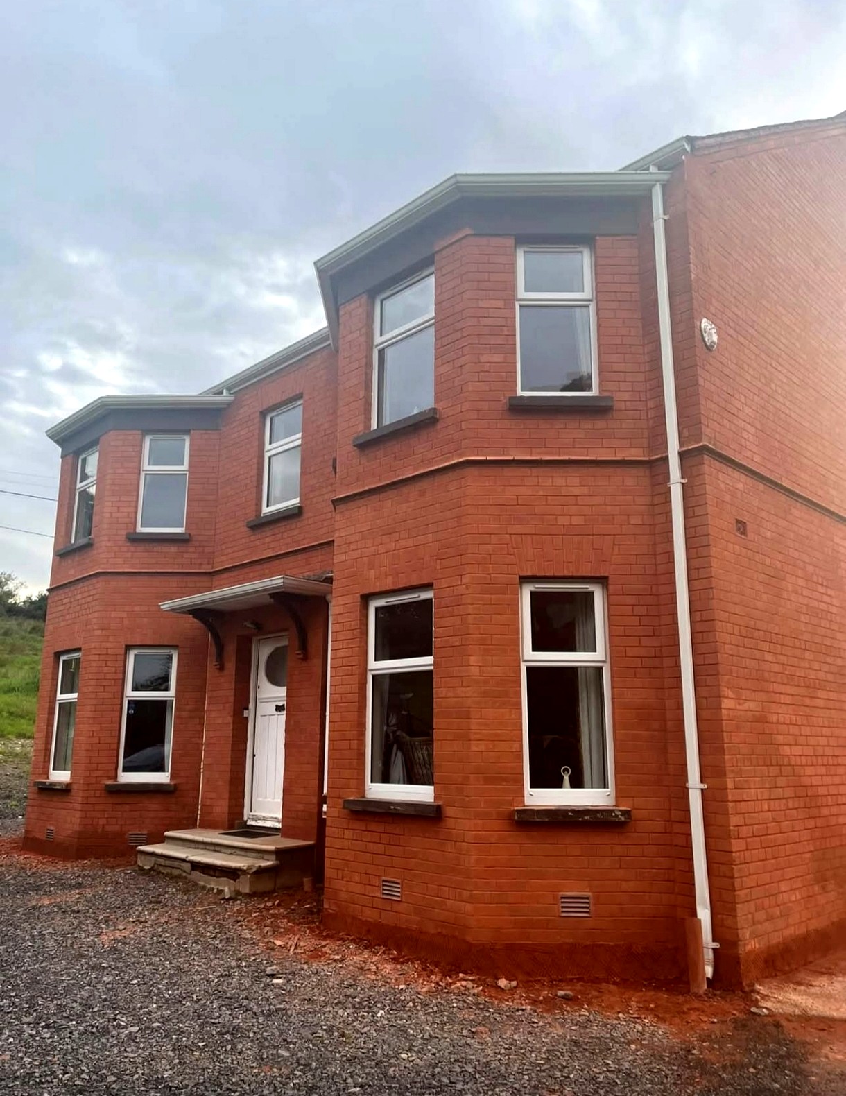
From the ground vs from the air.
Same house, same day. From the driveway the chimneys are barely visible. From the drone, every joint, pot and crack is on the screen.
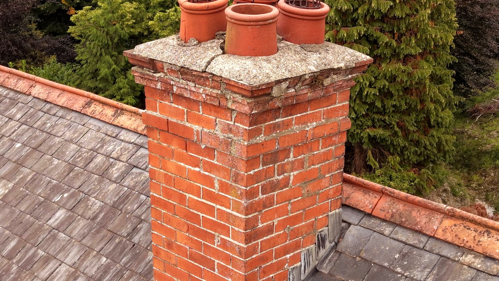
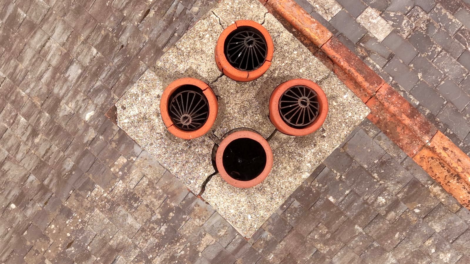
Cracked chimney crown
A crack is visible through the mortar crown around the pots. Water getting in here can work down into the stack.
Repair likely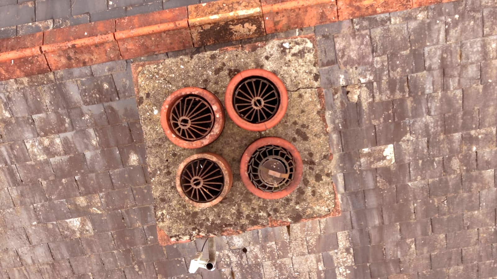
Weathered crown
Weathering and staining on the crown. No obvious crack from this angle, but worth watching.
Monitor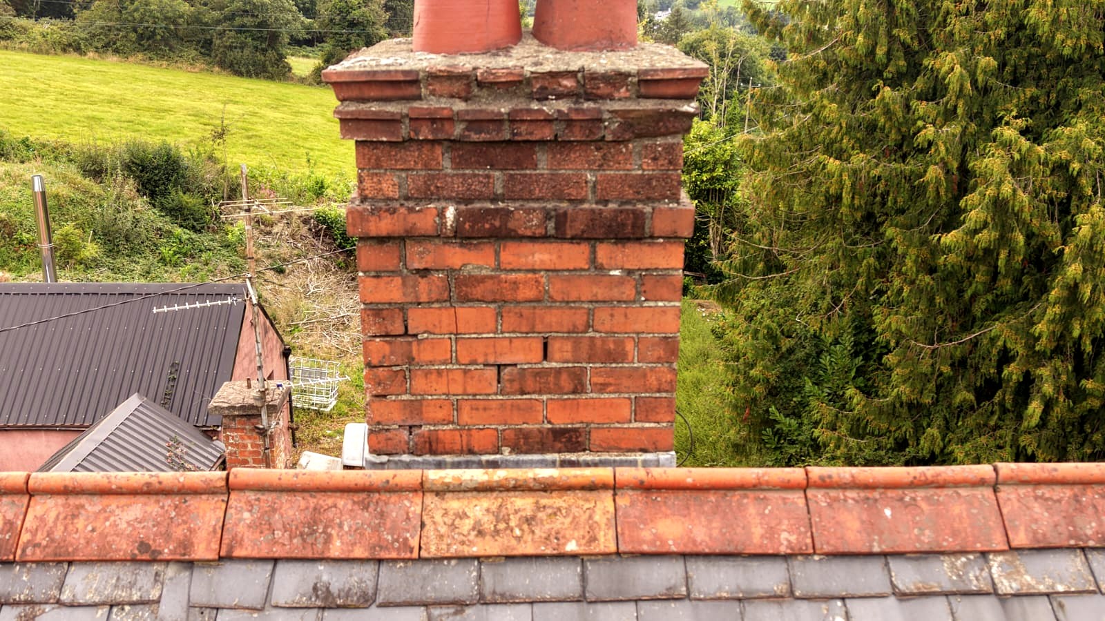
Ridge & stack junction
Ridge tiles and the stack junction checked along the full roofline.
No immediate action visibleNo ladders. No scaffold. Minutes in the air.
Scaffolding is for the work. It shouldn't always be the first step in finding the problem.
Access equipment is essential for many repairs. But using it only to discover the condition of a roof or chimney adds significant cost before the repair is even understood. A drone survey shows where the problem appears to be, what needs closer attention, and where physical access is genuinely worth paying for.
Spend on the repair — not on guessing where the repair is.
The traditional route
- 1.Arrange access
- 2.Mobilise equipment
- 3.Reach the defect
- 4.Discover condition
- 5.Decide repair
The Phoenix drone route
- 1.Share the property and concern
- 2.We plan the flight
- 3.High-level areas captured
- 4.Findings reviewed
- 5.Access and repair targeted
Not a replacement for every scaffold. A smarter way to decide when and where one is needed.
See the parts of the building the ground cannot show you.
Chimneys
Crowns, pots, mortar joints, cracking, flashings, vegetation.
Roofs
Slates, ridges, valleys, verges, displaced coverings, storm damage.
High gables
High-level pointing, open joints, eroded finishes, wall heads.
Parapets & copings
Open joints, displaced stone, water paths seen from above.
Rainwater goods
Gutters, outlets, blockages, overflow staining.
Heritage masonry
Towers, carved details, ruins, inaccessible façades.
Don't just tell the owner. Show them.
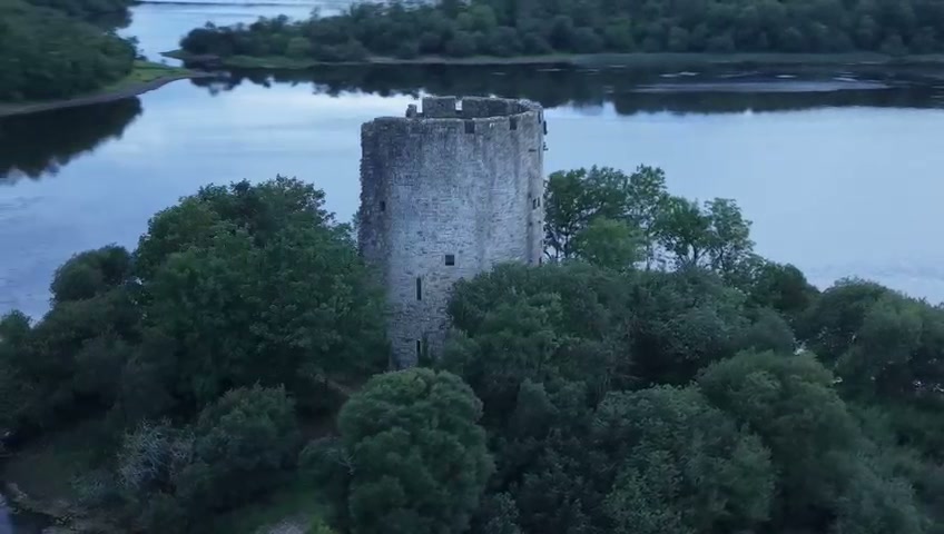
Tap a letter · Still from our drone footage
Battlements & wall head
The most exposed masonry on the tower. From the ground you can't see open joints or loose stones up here. From the air you can.
Closer inspectionWe describe what's visible — "appears consistent with", "requires closer inspection" — never a definitive diagnosis from imagery alone.
More than drone footage.
You're not buying a memory card of aerial video. You're getting a specialist's reading of your building.
High-resolution aerial imagery
Clear coverage of the agreed areas, weather and site permitting.
Targeted defect images
Close captures of areas that appear to need attention.
Plain-English findings
What is visible, and why it may matter to the building.
Priority guidance
Monitor, investigate further, plan repair or arrange access.
Repair discussion
Where it falls within our specialisms, a starting point for a quotation.
Visual record
Baseline evidence to compare before, during and after works.
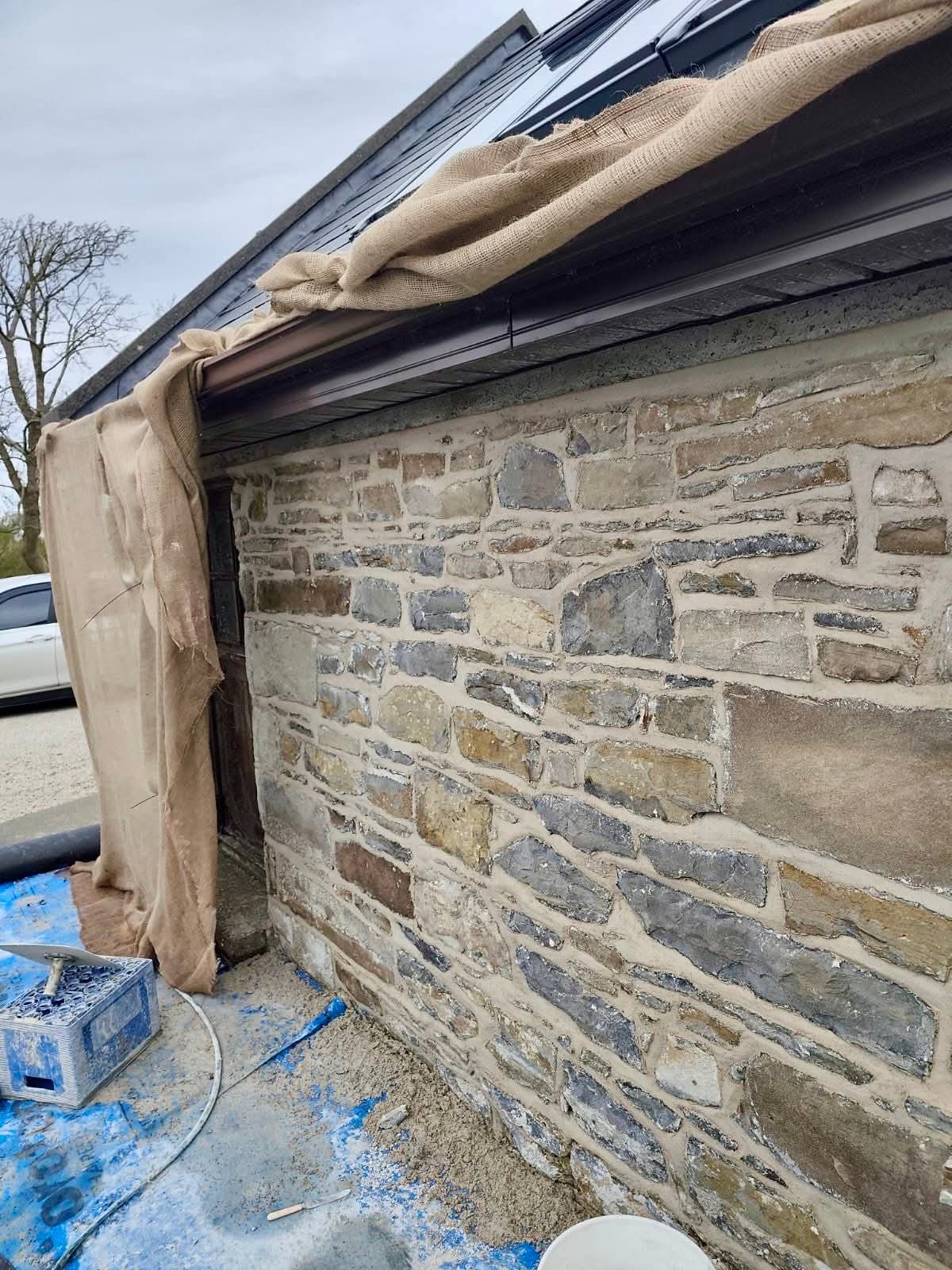
The camera is in the air. The knowledge is in the building.
A beautiful aerial image is only useful when somebody understands what they're looking at. We specialise in lime, stone, moisture and appropriate repair — so the footage is read in context, never handed back unexplained.
Deterioration, movement, failed joints.
How traditional mortars really behave.
Roof, wall and ground as one system.
The least invasive next step.
From first call to clearer evidence.
- Step 1
Tell us what's wrong
Send the location, a few photos and a short description.
- Step 2
We review the site
We check whether an aerial inspection suits the building and the question.
- Step 3
Flight planning
Planned around weather, surroundings, airspace and site safety.
- Step 4
Aerial capture
Agreed areas captured from the right angles — no exploratory access.
- Step 5
Review & findings
Imagery reviewed by a lime and stone specialist.
- Step 6
Decide the next step
Monitor, investigate, arrange access or move straight to repair.
When a drone survey makes sense.
“We have a leak but can't see where it starts.”
Review ridges, valleys, flashings and chimneys associated with water entry.
“The chimney looks bad from the ground.”
A close visual picture of crown, joints and junctions before paying for access.
“We're buying or restoring an old property.”
A record of high-level condition to support informed decisions.
“Storm damage is suspected.”
Check difficult areas for displaced coverings or impact, safely.
“We need an accurate heritage quote.”
Better imagery defines exactly where closer access is needed.
“The restoration is finished.”
Document completed high-level work for future comparison.
Old buildings deserve better than guesswork.
Roofs, walls, lime, stone and drainage work together. A symptom in one place can have its cause somewhere else. Whether the first view is from the ground or the air, our rule is the same:
Diagnose first. Intervene second.
Every flight is planned around the site, weather, airspace and people nearby. Aerial surveys are visual only — concealed, internal or structural conditions can't be confirmed from imagery alone.
See the problem before you pay to reach it.
From Kerry to Derry — all 32 counties.